
Lidar (Light Detection and Ranging)
Lidar has been around for quite some time. Recently, though the adaptation for the surveying industry has opened up opportunities to provide the client with highly accurate 3D maps at a fraction of the time required by typical field survey activities. The finished product can be incorporated into a project from the initial design concept to the finished product.
The base model can be used by several disciplines during the project design and construction phases to maintain a seamless, verifiable level of accuracy.
At project completion, lidar scans can be performed to provide a final as-built file for future use in any modifications or additions, removing the need for “redline” as-built data that may contain errors.
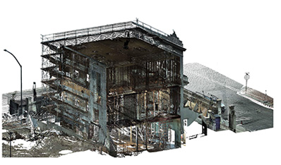
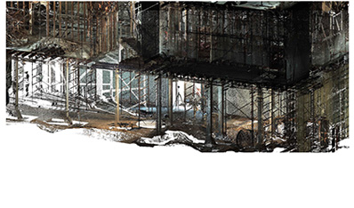
This scan was performed in Tucson, Arizona for the Marist College school building rehabilitation. This building was over 100 years old and was constructed of mud adobe and concrete. The building was abandoned years before as it was deemed unsafe.
The contractor Tofel/Dent needed an accurate survey to allow for a steel beam interior skeleton frame to support the building. This necessitated a survey to find the lowest joist elevation of the several hundred joists throughout the building.
The final proof of the survey verified tolerances of 1/8”-1/4”. After the scan was submitted and verified the architect for the project said “we should have done this prior to design to define these areas”.
Because of this scan, we were also able to provide the contractor with floor elevations, slopes and concrete wall plumb verifications.
The instrument used was a Leica P-50 and was processed using Leica Cyclone software.
UAS/Drone Technology
The Unmanned Aerial System technology was slow to ramp up in the United States. Europe and Asia are years ahead of the U.S. This is because of our complicated airspace system and a long drawn out process to allow drones to fly in most areas.
As a current Commercial multi engine pilot and after a review, we were granted FAA Part 107 Remote Pilot status.
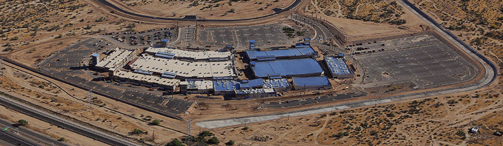
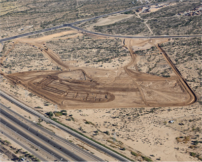
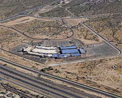
We have performed multiple mapping projects from an Amazon Express site in Tucson to several 40-150 acre sites in Wisconsin to US Border Patrol facilities in Indio California. Each of these projects required different research, setup and mapping requirements along with differing climate conditions from 10° and snow in Wisconsin, to 90° desert heat in Indio. The proofs returned from our ground control checks verified accuracies far better than traditional aerial mapping techniques.
The following photos files provide a small insight of our capabilities.
Video Insights
Encantada at Rita Ranch – 01
Mica Mountain High School in Rita Ranch 01
Encantada at Rita Ranch – 02
Mica Mountain High School in Rita Ranch 02